Activity Overview
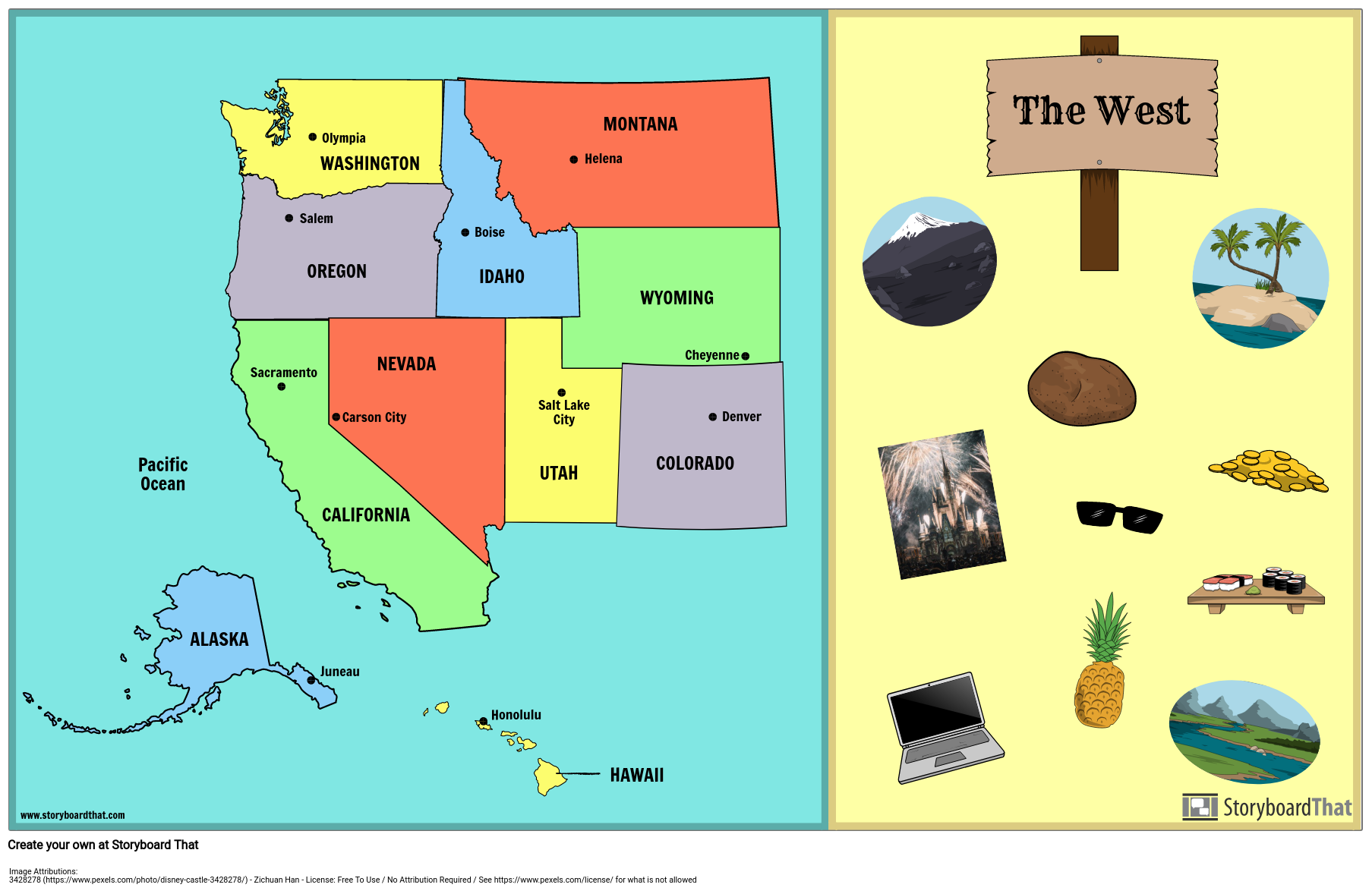
It is important for students to know the locations of the states on a map, and the capital cities of each state. Filling out a blank map or creating a map from scratch helps students retain information in a more concrete way. For this activity, students will create a poster showing the West states, capitals, and any major bodies of water. Students will also add illustrations that apply to the West. Students may use a map of the United States, or use the individual states template provided to create their own map.
Template and Class Instructions
(These instructions are completely customizable. After clicking "Copy Activity", update the instructions on the Edit Tab of the assignment.)
Due Date:
Objective: Create a map of the West region, including the state names, capital cities, and illustrations.
Student Instructions
- Click “Start Assignment”.
- Fill in the blank map of the West, including states and capitals OR create a map of your own using the individual states provided. Use the "search" bar to find regions and states.
- Add illustrations throughout the map as desired to make it more colorful and interesting.
Lesson Plan Reference
- CCSS: RI.4.4 - Determine the meaning of general academic and domain-specific words or phrases in a text relevant to a grade 4 topic or subject area.
- CCSS: RI.4.7 - Interpret information presented visually, orally, or quantitatively (e.g., in charts, graphs, diagrams, time lines, animations, or interactive elements on Web pages) and explain how the information contributes to an understanding of the text in which it appears.
- CCSS: RI.4.10 - By the end of year, read and comprehend informational texts, including history/social studies, science, and technical texts, in the grades 4-5 text complexity band proficiently, with scaffolding as needed at the high end of the range.
How to Teach Cartography and Mapmaking Techniques
Introduction to Cartography and Mapmaking
Begin by introducing students to the concepts of cartography and mapmaking. Explain that cartography is the art and science of creating maps, and maps are essential tools for understanding and representing the world around us.
Fundamentals of Map Elements and Design
Teach students about the fundamental elements of maps, including: Title: The map's name or what it represents. Scale: The relationship between distance on the map and distance in the real world. Legend: Symbols and colors used to represent features on the map. Compass Rose: Indicates cardinal directions (north, south, east, west). Key/legend: Explains the meaning of symbols and colors used on the map. Grid or coordinates: Helps with location and measuring. Projection: The method used to flatten the Earth's surface onto a two-dimensional map.
Hands-On Mapmaking Activity
Engage students in a hands-on mapmaking activity. Provide them with blank maps and encourage them to create their own maps of a specific area. Guide them on including the map elements mentioned in Step 2. Discuss different map types, such as topographic maps, thematic maps, and physical maps, and let students choose the type that best suits their mapmaking activity.
Map Critique and Reflection
After completing their maps, have students present and discuss their creations. Encourage them to explain the design choices they made and how their maps represent their chosen areas or themes. Facilitate a discussion on the importance of accurate mapmaking, the role of maps in various fields (geography, urban planning, environmental science, etc.), and the influence of technology on modern cartography.
Frequently Asked Questions about US Regions West - Maps
What are the major national parks and natural landmarks in the Western United States, and where can I find detailed maps for these attractions?
Major national parks and natural landmarks in the Western US include the Grand Canyon, Yellowstone, Yosemite, Zion, and Arches. Detailed maps for these attractions are typically available at visitor centers within the parks, on their official websites, or through reputable cartographic resources.
Are there maps that illustrate the distribution of cultural communities and Native American reservations in the Western US?
Yes, there are cultural and demographic maps that provide insights into the distribution of cultural communities, including Native American reservations, in the Western United States. These maps can be found in academic publications, government resources, or cultural heritage organizations dedicated to the preservation of indigenous cultures.
How can storyboards effectively convey information about the diverse maps of the Western United States, from topographical and geological maps to tourist and transportation maps, and facilitate interactive learning for students?
Storyboards can effectively convey information by visually presenting diverse maps. Incorporating images, descriptions, and interactive elements, such as legend interpretation and map analysis activities, storyboards engage students, making learning about Western US maps an interactive and memorable experience.
How can the use of storyboards and worksheets enhance students' ability to read and interpret maps effectively, helping them develop spatial awareness and geographical skills when exploring the Western United States?
Storyboards and worksheets enhance students' map-reading skills by offering a structured approach to map interpretation. They encourage students to understand symbols, scales, and geographical context. Interactive exercises foster spatial awareness and geographic literacy, helping students develop essential skills for navigating and comprehending maps of the Western US.
More Storyboard That Activities
US Regions: West
- 3428278 • Zichuan Han • License Free To Use / No Attribution Required / See https://www.pexels.com/license/ for what is not allowed
Testimonials
Introductory School Offer
ONLY$500
- 1 School
- 5 Teachers for One Year
- 1 Hour of Virtual PD
30 Day Money Back Guarantee • New Customers Only • Full Price After Introductory Offer • Access is for 1 Calendar Year
© 2025 - Clever Prototypes, LLC - All rights reserved.
StoryboardThat is a trademark of Clever Prototypes, LLC, and Registered in U.S. Patent and Trademark Office


