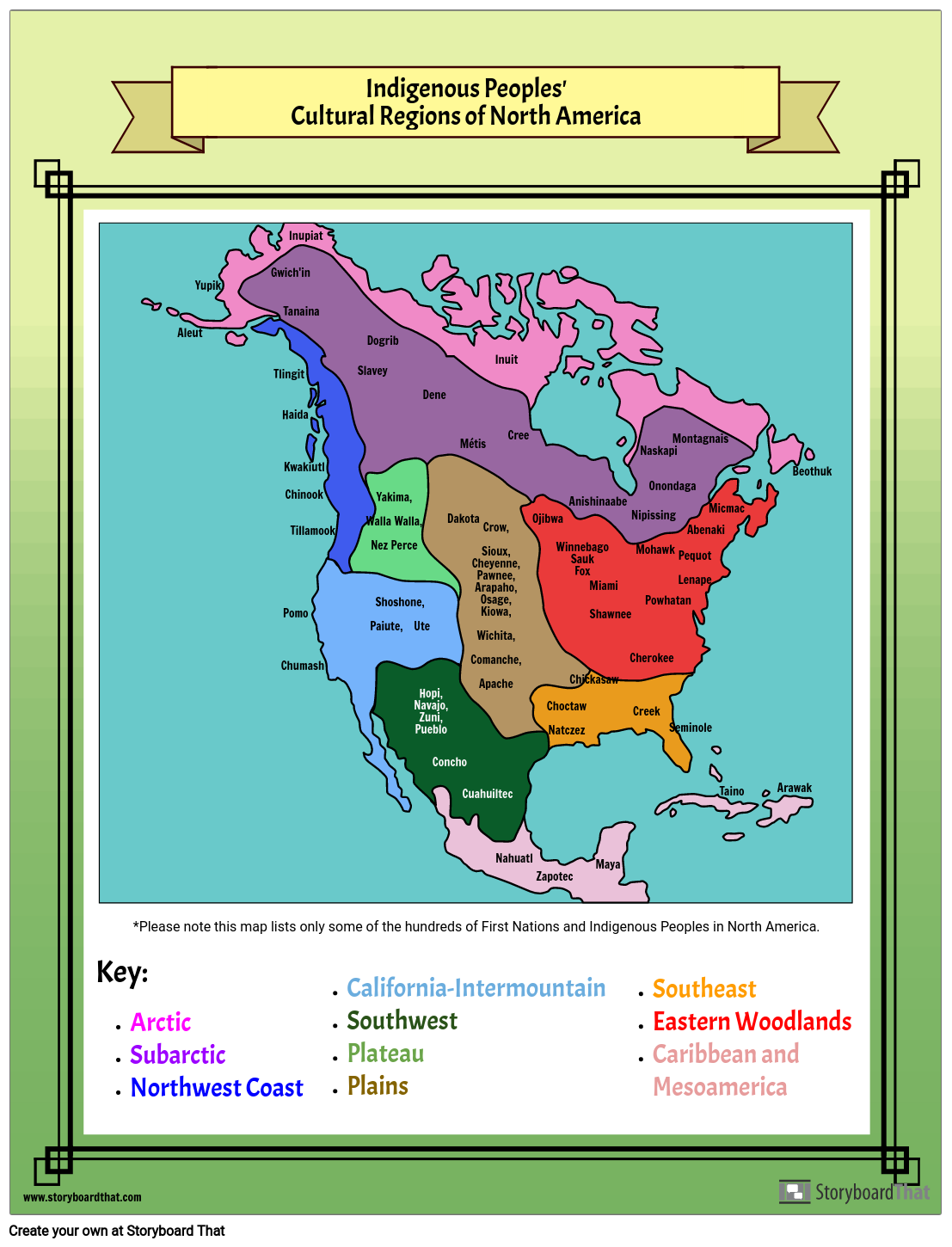
Indigenous Peoples of North America Map

Kuvakäsikirjoitus Kuvaus
Students can change the colors of the map to match the key demonstrating their knowledge of the different regions. Then, they can add the names of Indigenous Peoples that are native to each region. Teachers can add more requirements to this activity asking students to include more information about each region in the boxes such as physical features, climate or states/provinces included in the regions.
Kuvakäsikirjoitus Teksti
- Indigenous Peoples' Cultural Regions of North America
- Aleut
- Yupik
- Tlingit
- Gwich'in
- Haida
- Chumash
- Pomo
- Kwakiutl
- Tanaina
- Chinook
- Inupiat
- Tillamook
- Slavey
- Dogrib
- Yakima,Walla Walla,Nez Perce
- Shoshone, Paiute, Ute
- Hopi, Navajo, Zuni, Pueblo
- Dene
- Concho
- Dakota
- Métis
- Crow,Sioux,Cheyenne,Pawnee,Arapaho,Osage,Kiowa,Wichita,Comanche,Apache
- Cuahuiltec
- Inuit
- Nahuatl
- Cree
- Ojibwa
- Zapotec
- ChoctawNatczez
- WinnebagoSaukFox
- Anishinaabe
- Chickasaw
- Maya
- Miami
- Shawnee
- Creek
- Nipissing
- Cherokee
- Mohawk
- Naskapi
- Powhatan
- Onondaga
- Seminole
- PequotLenape
- Montagnais
- Abenaki
- Micmac
- Taino
- Arawak
- Beothuk
- Name Date
- Key:ArcticSubarcticNorthwest Coast
- *Please note this map lists only some of the hundreds of First Nations and Indigenous Peoples in North America.
- California-IntermountainSouthwestPlateauPlains
- SoutheastEastern WoodlandsCaribbean and Mesoamerica
Yli 30 miljoonaa kuvakäsikirjoitusta luotu

